Modified on
How Drones in Construction is Changing the Industry?

Skill-Lync
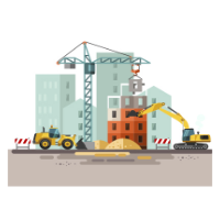
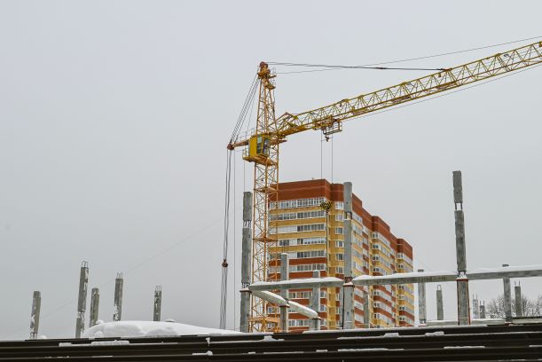
The construction industry is no stranger to technological advancements, but the rise of drone technology is revolutionising the industry in ways never before seen. From surveying and mapping to construction progress monitoring, drones bring unprecedented accuracy, efficiency, and safety to the construction process. This blog will look at how drone technology is changing the industry and how it's poised to transform the construction landscape in the years to come.

What are Drones?
Drones are Unmanned Aerial Vehicles (UAVs) controlled remotely or autonomously. They are typically used for,
- Aerial photography
- Videography
- Surveillance
- data collection
Drones are equipped with advanced sensors and cameras that can capture high-resolution images and videos of the construction site, allowing engineers to run detailed analyses and track the progress of a project. Data from a few years ago has shown that the construction industry has the highest growth rate for drone usage, at a staggering 239%, the highest in any industry. Research has also shown that drones have boosted construction workers' safety by 55%.
Types of Construction Drones
Even though there are many different kinds of drones, construction often uses commercial drones. While some versions have fixed wings, others have moving blades. Their usage and design are the key differences between them.
Fixed-Wing Drone
Fixed-wing drones resemble small aeroplanes which can fly at high altitudes and follow a predetermined path. Hence they are effective for pre-construction tasks like topographic mapping and extensive area surveys. They can only fly forward. Hence they are ineffective in areas with many barriers and confined spaces.

Rotary Drone
Rotary drones are simpler to manage than fixed-wing drones since they can hover and maintain stability thanks to their rotor configuration. These drones are used for the following.
- Airborne inspections
- Structural scans
- Aerial Photography
- Close-range monitoring

How are Drones Used in Construction?
Drones can increase productivity, reduce expenses, and streamline workflow thanks to their real-time data recording capabilities and distinct aerial edge. Here are a few applications for drones in the building industry.
Topographic Mapping and Land Survey
Planning intricate, extensive building projects requires consulting topographic maps. They can expose expensive design mistakes that are inappropriate for a given terrain. Topographic maps are useful, but they are costly and labour-intensive to construct.
- Drones can significantly reduce the time needed to visualise the topography of a site because of their capacity to map large areas of land.
- It guarantees the correctness of the map before the project is started and aids in keeping the project on budget and schedule.
- Visualise the topography site data can be gathered to help with design and feasibility analysis.
- 3D models can also be created from high-resolution photographs taken by drones. The construction team can use them to identify problems before they arise, thus saving time and money.
Equipment Tracking
Knowing where the equipment is at each job site is a challenge that almost every project manager has encountered. Typically, several lengthy spreadsheets are involved, which can rapidly become an Excel headache. With the help of drones, however construction companies can track the location of their equipment in real time, allowing them to manage their resources better and reduce downtime.
- This can be especially useful for large-scale projects, such as bridges and highways, where monitoring progress from the ground can be difficult.
- It can help to reduce the amount of time spent searching for equipment, as well as reduce the risk of theft or damage.
- By tracking the location of equipment, companies can also ensure that the right equipment is used for the right job.
Remote Monitoring and Progress Reports
When clients cannot visit a site in person, drones may generate stunning overhead pictures and help them understand the project's progress.
- With their ability to capture aerial footage and images, drones can provide an efficient way to track the progress of a project and ensure that it is on schedule.
- Drones can capture images of the construction site from various angles, allowing for a comprehensive view of the entire project. This can be especially useful for keeping track of the progress of a project, as it allows for quick and easy comparisons between the current state of the construction site and the original plans.
- Drones can enhance team cooperation internally by delivering data to connected software during flyovers, in addition to client communications.
- Moreover, drones can leave a good paper trail that teams can later access.
Structure Inspection and Photography
Drones have revolutionised the way construction projects are inspected and photographed. Drones can deliver a key inspection in place of large scaffolding and labour-intensive machines.
- A drone can be flown around buildings to observe minute details and collect high-resolution imagery for analysis.
- Heat leaks, cold spots, and any electrical problems can all be found with thermal sensors mounted on a drone. In the long run, this level of quality control benefits client relationships.
- Drones can be used for planned maintenance on larger buildings like scaffolding, towers, bridges, and roofs.
- A single drone operator can complete the same task, which would require an entire surveyor team.
Conclusion
The rise of drone technology in construction has been a revolutionary development for the industry. To learn more about the new technologies and developments, check Skill-Lync’s website and blogs. We offer various PG programs in civil engineering domains, including BIM, Structural design, and Drafting. Start your upskilling journey by booking a free demo!
Author

Navin Baskar
Author
Skill-Lync
Subscribe to Our Free Newsletter

Continue Reading
Related Blogs
Through a graphical user interface, the user communicates with HEC-RAS (GUI). Making the software simple to use while still keeping a high level of user efficiency was the key goal while designing the interface.
04 Aug 2022
A stiffness modifier is a modification factor that is generally used in the properties of cross section such as moment of inertia, torsion etc., aiding in reducing the stiffness in concrete sections to model cracked behaviour of concrete. The stiffness modifier is applied only on concrete structures as it cracks on loading.
11 Aug 2022
Ellipse is a fundamental component of a conic section and shares many characteristics with a circle. An ellipse is oval in shape as opposed to a circle. An ellipse is a shape with an eccentricity less than one that symbolises a group of points whose distances from its two foci are added up to a fixed value. Everyday examples of the ellipse include the shape of an egg as well as the race track in a sports field.
16 Aug 2022
Revit enables professionals to access design and rendering functions in an exceedingly single program. this enables the designs to be created within the identical software that renders the ultimate images.
01 Sep 2022
A topographic map, or toposheet, depicts a three-dimensional terrain area in two dimensions. Since topographic maps display the landscape's horizontal and vertical location, they set themselves apart from other types of maps. It uses a combination of colour, symbols, labels, contour lines, and other graphical elements for visual representation.
25 Oct 2022
Author
Skill-Lync
Subscribe to Our Free Newsletter
Continue Reading
Related Blogs
Through a graphical user interface, the user communicates with HEC-RAS (GUI). Making the software simple to use while still keeping a high level of user efficiency was the key goal while designing the interface.
04 Aug 2022
A stiffness modifier is a modification factor that is generally used in the properties of cross section such as moment of inertia, torsion etc., aiding in reducing the stiffness in concrete sections to model cracked behaviour of concrete. The stiffness modifier is applied only on concrete structures as it cracks on loading.
11 Aug 2022
Ellipse is a fundamental component of a conic section and shares many characteristics with a circle. An ellipse is oval in shape as opposed to a circle. An ellipse is a shape with an eccentricity less than one that symbolises a group of points whose distances from its two foci are added up to a fixed value. Everyday examples of the ellipse include the shape of an egg as well as the race track in a sports field.
16 Aug 2022
Revit enables professionals to access design and rendering functions in an exceedingly single program. this enables the designs to be created within the identical software that renders the ultimate images.
01 Sep 2022
A topographic map, or toposheet, depicts a three-dimensional terrain area in two dimensions. Since topographic maps display the landscape's horizontal and vertical location, they set themselves apart from other types of maps. It uses a combination of colour, symbols, labels, contour lines, and other graphical elements for visual representation.
25 Oct 2022
Related Courses